Other UpNorth Info
Lodging
Dining
Fishing
Winter Fun
Fun Things To Do
Real Estate


Black River National Forest Scenic Byway

The National Black River Scenic Byway includes, Great Conglomerate Falls, Potawatomi, Gorge, Sandstone, and Rainbow Falls. As you visit our waterfalls, stop and take notice of the signs explaining the conglomerate rock formations.

Directions: From Hwy. US 2 in Bessemer take Powderhorn Rd North. When you come to the T in the road at the stop sign, make a left hand turn on Black River Rd. You will find all the waterfalls on this Road. This road is approximately 14 miles long, ending in the only Harbor & Marina operated by the USDA Forest Service in the lower 48 states.

Great Conglomerate Falls - This is a very large waterfall which is divided by a wide conglomerate rock formation. This waterfall is well marked. Walking trail 3/4 mile.

Potawatomi Falls - Potawatomi, which is barrier free, is one of the most beautiful waterfalls on the Black River. This waterfall is well marked. A restroom is available at this site. Walking trail is approximately 1/8 mile.

Gorge Falls - This conglomerate canyon has a 34 foot drop. Potawatomi and Gorge Falls are accessible by the same parking area. Walking trail is approximately 1/8 mile.

Sandstone Falls - This waterfall meanders over rocks giving it a unique appearance. It is located on a beautiful spot on the Black River, with a well marked, short 1/4 mile walking trail.

Rainbow Falls - A Beautiful Waterfall that is extremely photogenic on the East part of the River. Enjoy the scenery on your 1/2 mile walk to the waterfall. Take is easy, there are many stairs.

Pictures 
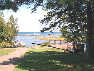
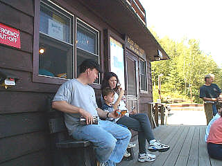
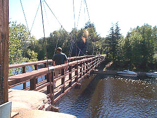
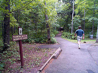
of the Black River Scenic Byway
(thanks to Arlene Schneller for the photos)


Black River Harbor


Potawatomi Falls Trail


Potawatomi Falls


Gorge Falls


We are Proud Members of the

Network

This site and all pages herein have been designed by and are hosted
by the Internet Specialists at UpNorth Info, a division of BOTEK CORPORATION
Copyright © 2002-3 Botek Corporation All Rights Reserved.

Fishing in Northern Wisconsin and Western UP of Michigan Snowmobiling in Northern Wisconsin and Western UP of Michigan Lodging in Northern Wisconsin and Western UP of Michigan

Here a list of the towns, counties and areas covered by these web sites.  Since information is being added and updated constantly, some areas my not be completely represented yet.

Wisconsin: Apostle Islands, Ashland, Alvin, Arbor Vitae, Argonne, Blackwell, Boulder Junction, Bradley, Brantwood, Carter, Cavour, Chequamegon Bay, Clearwater Lake, Clifford, Conover, Crandon, Cresent Lake, Eagle River, Enterprise, Harshaw, Hayward, Hazelhurst, Heafford Junction, Hiles, Hurley, Jennings, Lac du Flambeau, Lake George, Lake Tomahawk, Land O Lakes, Laona, Long Lake, Manitowish Waters, McNaughton, Mercer, Minocqua, Mole Lake, Monico, Newbold, Park Falls, Pelican Lake, Phelps, Popple River, Presque Isle, Rhinelander, St. Germain, Sayner, Star Lake, Starks, Sugar Camp, Three Lakes, Tomahawk, Tripoli, Turtle Flambeau Flowage, Wabeno, Winchester, Woodboro, Woodruff, Lake Michigan, Lake Superior and the counties of Onieda, Vilas, Iron.
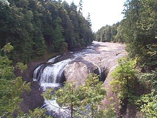
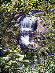
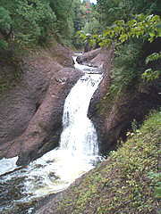
Michigan:
Western Upper Peninsula of Michigan and the towns of Marinesco, Ironwood, Bessemer, Wakefield, Iron River, Iron Mountain, Lake Gogebic, Bergland, Silver City, Hancock, Watersmeet, Lake Michigan, Lake Superior and others.